
Technical Info
Hang gliding, and the desire for soaring flight, introduced me to seeing weather in new ways. In particular, it gave me an appreciation for micro-meteorology, which is about local effects which are below the scale of forecasts and weather maps. Below are a few photos or weather observations I have found intriguing.
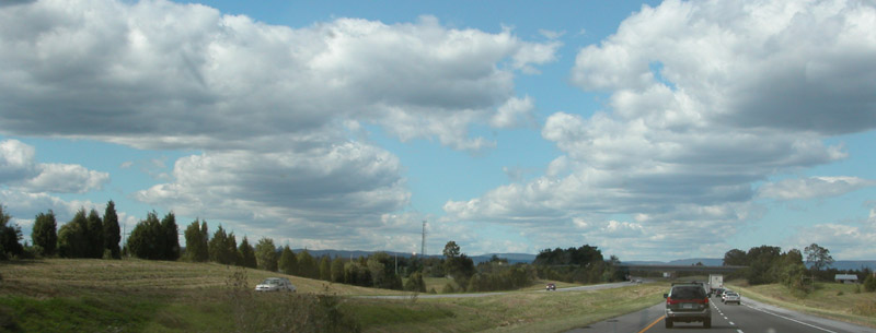
Note the flat, dark bottoms of the rows of clouds. The flat bottoms indicate that thermals are still feeding these clouds, which means there is ample "lift" below them. In between the streets you can see a couple of small wisps of "cotton puff" clouds - these are the late, decaying stage of a cumulus cloud cycle.
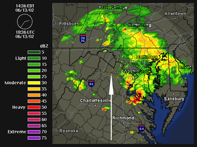
Terrain often affects weather, and most everyone knows of certain local areas that seem to have more, or less, rain than other nearby places. One place that seems to catch more rain (or, at least more clouds) than nearby areas is on I-66 on the way into Washington, DC. There is a low ridge on the western edges of Loudon and Rappahannock counties which does not look to be more than 1000 ft high, at most. On frequent drives along this section of I-66 I often noticed it was cloudy or raining there when weather was more clear on either side. One day, after making this drive on a rainy day, I captured this radar animation from Weather Underground. I edited it to add a white arrow to point to the stationary storm on this ridge. Even though storms are moving through the area, at this one location a small storm remains stationary.
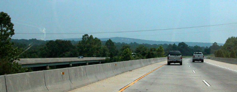
This is a view of the ridge causing this local storm, as seen from I-66 heading East:
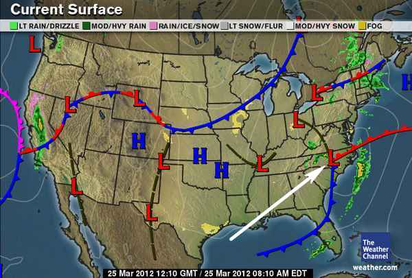
Our weather in the US (which is more variable and active than most other places in the world), is a series of high and low pressure regions moving across the country. You can visualize high and low pressure areas as mountains and valleys in the atmosphere. A high pressure area has more air above it, while low pressure areas have less air above them. When you look at the lines of constant pressure (isobars) drawn on a weather map, you can think of these as the contour lines on a topographical map. Of course, the higher mounds of air in the high pressure areas want to flow to the valleys of the low pressure areas. This is complicated, however, by the rotation of the earth. The air cannot simply flow from the high to the low pressure areas in a straight line because the air masses are rotating with the earth. This gives rise to the Coriolis Effect, which causes are High and Low pressure masses to rotate. In the northern hemisphere the rotation is clockwise around a high, and counterclockwise around a low.
The rotating air masses are generally quite large, usually spanning many states. The winds in any one location do not generally show the rotation, but only a seeming straight direction for that area. Therefore I was surprised one day to check my local weather radar and see a clear counter-clockwise rotation of local storm cells (the center of rotation is in North Carolina):
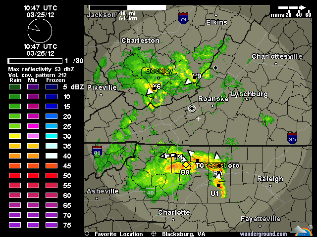
This aroused my curiosity as to the local weather map, and sure enough, the Weather Channel map showed the 'L' located almost exactly at the center of the rotating storms.